WingX Pro Software on the iPad
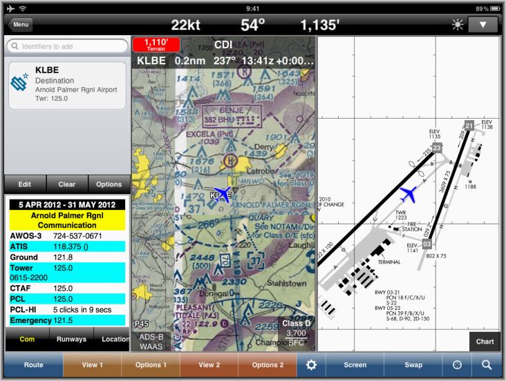
On this screen capture we're using WingX Pro from Hilton Software to aid in our situational awareness during taxi at the Latrobe airport. The right panel shows that we're on taxiway Alpha between Charlie and Bravo on our way to runway 23. Displayed on the left panel are the frequencies for this airport and on the center is our position on the sectional chart.
 |
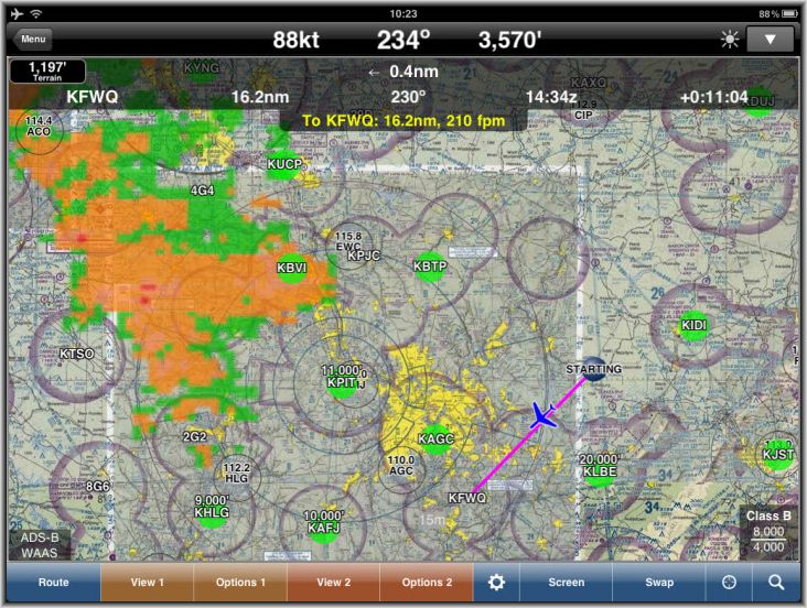
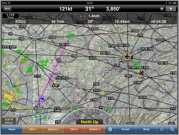
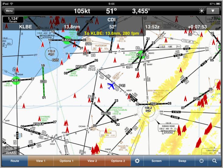
This is the Detroit sectional chart displayed full-screen overlain with our route, current position, and weather on our flight from a point north of Latrobe to the Rostraver airport.
 |
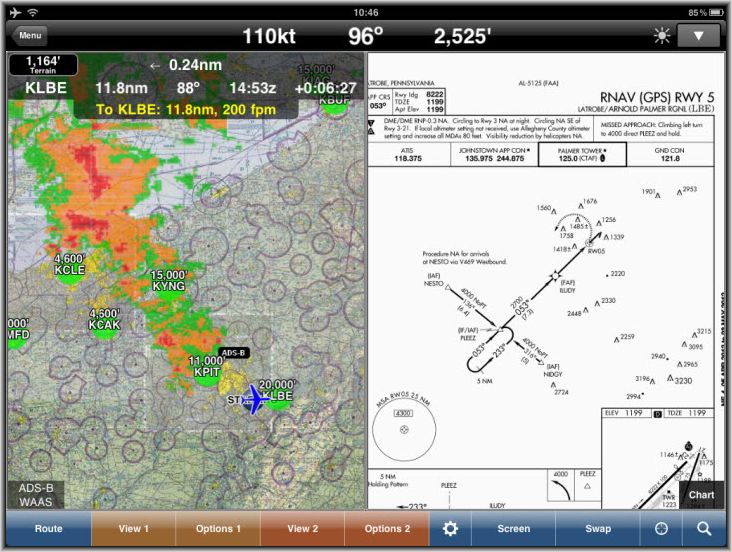
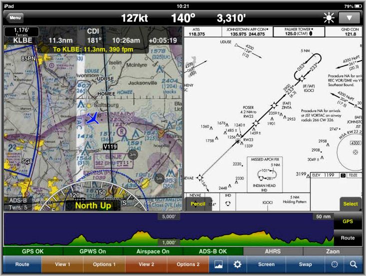
Here's an example of splitting the screen showing our current location and weather on the left panel and the Latrobe instrument approach plate on the right panel.
 |
Like most general aviation aircraft that have been retrofitted with ADS-B capability our unit is receive only and thus cannot ping and wake up nearby ground stations. That design decision by the FAA means that you will only rarely see traffic displayed on the iPad, but in the event that you're flying in the area of another aircraft with ADS-B out on 978 MHz then you will pick up traffic reports directed to them. Here was such an occasion where we saw an airplane over Mid-State at 3,925 feet and another southeast of University Park at 4,325 feet.
 |
IFR Chart, Runway Extenstions, Obstacles, and Terrain.
 |
VFR Chart, Runway Extenstions, Terrain, and Airspace.
 |
Here's an image taken in September, 2012 showing a feature recently added to WingXPro: a graphical representation of terrain below the aircraft.
 |